Wild weather not done with Waitaki yet
Ashley Smyth
07 October 2024, 1:15 AM
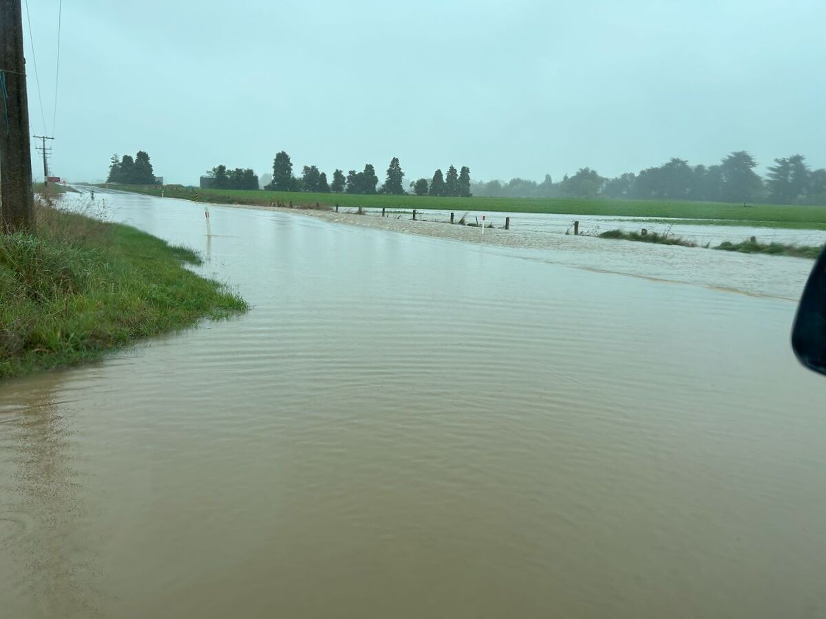
 State Highway 85 which was closed due to flooding just inland from Palmerston on Friday. Photo: Ashley Smyth
 While a lot of Otago is still in recovery mode from the weekend’s wild weather, it seems the rain and wind isn’t quite done with us yet.
Some rain is expected in parts of the south this afternoon and this evening, and the forecast for Tuesday has MetService issuing weather watches for heavy rain and strong winds, with snow to follow.
The west of the South Island is mostly in the firing line this time, although Otago and Canterbury lakes and headwaters 15km east of the main divide could be affected by heavy rain from about 6am to 6pm tomorrow (Tuesday).
The Canterbury High Country looks likely to be buffeted by Northwest winds approaching severe gale strength in exposed places from 9am to 5pm tomorrow, while the coastal areas of Southland and Clutha could be in store for west to northwest winds approaching galeforce, from 9pm on Tuesday into Wednesday, with winds expected to turn southwest on Wednesday morning.
The northwest winds are going to pump up the temperature in eastern areas, but after the rain passes there’s a cool southerly wind that moves up the country and brings a noticeable drop to afternoon temperatures.
Gore might struggle to make double digits on Wednesday while Hastings goes from above average temperatures on Tuesday to below average on Thursday.
The cool air intrusion brings about risk of snow and there’s already a Road Snowfall Warning in force for Milford Road from Tuesday evening and Southland could get snow down to 500m on Wednesday, MetService meteorologist Lewis Ferris warns.
“The recently saturated southeast can expect some wet weather this week. There are a few showers due today, potentially some heavier ones this afternoon/evening,” he says.
“Tuesday brings some passing rain as the front moves through and then a final bout of rain on Wednesday as the southwest wind pushes over. Thursday and Friday are looking mainly fine at this point.”


