Local Weather with WAL (Waitaki App Limited)

Staff Reporter
12 May 2023, 5:48 AM
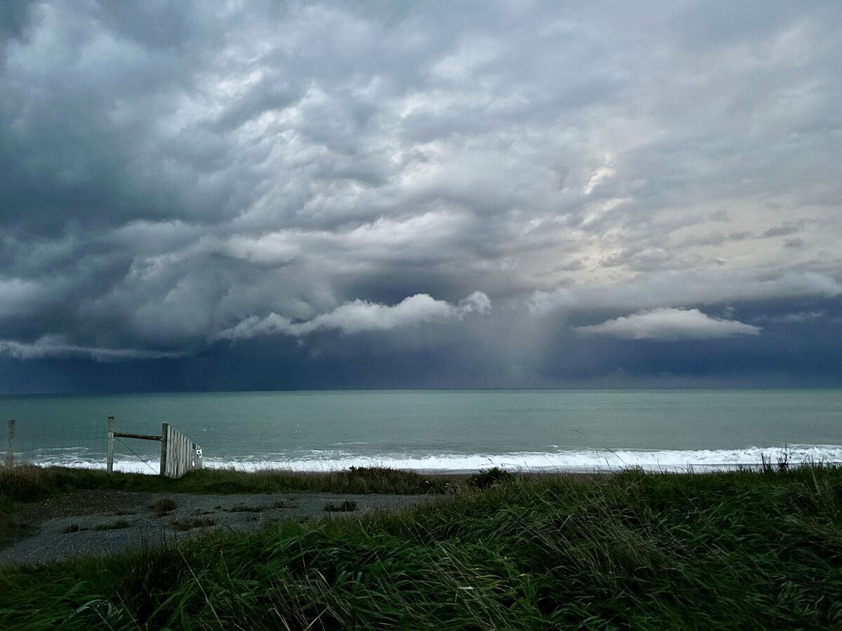 Storm clouds gathering off the coast of Kakanui late on Wednesday afternoon. PHOTO: Ashley Smyth
Relatively settled weather is returning in time for the weekend.
A cold west to southwest blast galloped across the country on Wednesday and Thursday, bringing gales and showers with snow down to 300m inland in places.
Thunderstorms also rolled past the Waitaki coast on Wednesday afternoon, with cumulonimbus clouds and lightning putting on a spectacular display near Oamaru. Metservice reported over 12,000 lightning strikes were detected over the whole of Aotearoa New Zealand and surrounding waters during the 24 hours to 8am Thursday, although the bulk of these occurred over the Tasman Sea to the west of the North Island.
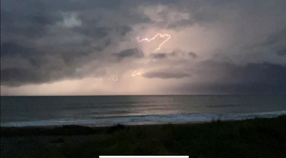
Lightning show off the Kakanui coast. PHOTO: Ashley Smyth
Looking ahead, Coastal Waitaki is looking mostly fine with light winds, turning to showers on Sunday afternoon and evening.
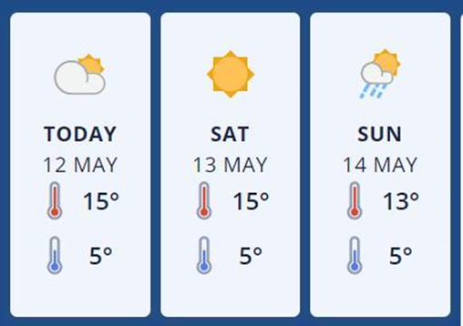
Metservice forecast graphic: Oamaru
The weekend forecast inland for Omarama is mostly fine with lingering showers clearing later on Friday. Light to moderate westerlies develop late Saturday, turning lighter southerly on Sunday with isolated showers. With overnight lows hovering around zero some frosts are likely in sheltered areas.
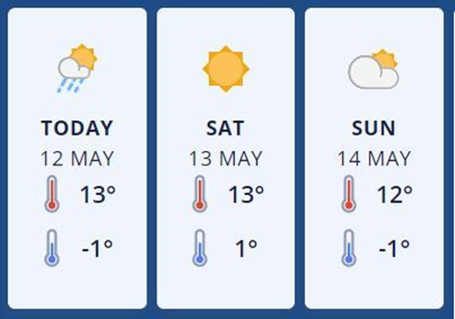
Metservice forecast graphic: Omarama
See current conditions and real time weather forecasts for Oamaru and Omarama