First week of summer is bringing the heat
Staff Reporter
02 December 2024, 9:30 PM
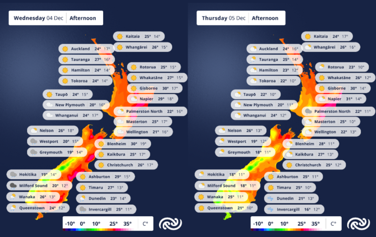
 Just in case you didn't already notice, summer has arrived. Graphic: MetService
Summer is officially here - both noticeably and meteorologically.
MetService is forecasting maximum temperatures this week of up to 8°C above average for this time of the year, for the South Island east coast, Gisborne and Hawke’s Bay, MetService Meteorologist Clare O’Connor says.
This is because of humid sub-tropical air driven by strong northerlies moving over the country.
A mix of warnings, watches, and alerts have been issued for heavy rain, strong winds, and high temperatures, but most apply to the North Island, deep south and West Coast.
The most likely to affect North Otago, is a Strong Wind Watch, which has been put in place for Dunedin and further south from 11pm Wednesday, to 7pm Thursday.
West to southwest winds may approach severe gale in exposed places, with a moderate chance of being upgraded to a warning.
MetService’s Heat Alerts have begun for the summer season, with the first likely to be issued this week, Clare says.
“This air is coming to Aotearoa from the subtropics and bringing subtropical temperatures with it. Not only are we expecting daytime maximum temperatures to reach the low thirties for the eastern North Island, overnight temperatures will also be unusually warm.
“Midweek, many areas of the lower North Island and upper South Island will experience minimum temperatures of 17°C, no doubt disrupting sleep.
"Our first Heat Alerts for higher-than-average overnight temperatures are expected to be issued for locations such as Napier and Blenheim, both of which may even have overnight low temperatures as high as 19°C as a result of this airmass,” she says.
Heat alerts are issued by the MetService forecasting team when temperatures are expected to be extreme, i.e. hotter than a typical hot summer day.
Heat Alerts are triggered when a single day’s maximum temperature is high, or when sustained periods (two or more days) of very high average temperatures occur, in particularly when overnight temperatures are higher than usual, making keeping cool more difficult, and increasing the risk of health-related health issues. More information can be found on the MetService website.
As the weekend approaches, the warmer air gives way to showery southwesterly winds and a return to average temperatures for this time of year. However, a building high-pressure system will bring blue skies to most of the country to end the week.


