Cold air brings risk of snow, thunderstorms, hail

Staff Reporter
16 September 2024, 1:21 AM
Southerly outbreaks have kept snow seekers in the far south happy over the past several days and MetService is forecasting more snow to kick off this week as cold air sweeps up the country.
Several regions are at risk of seeing thunderstorms today (Monday) and on Tuesday, with hail and gusty winds potentially accompanying heavy showers. More fast-moving rain bands are forecast through the second half of the working week.
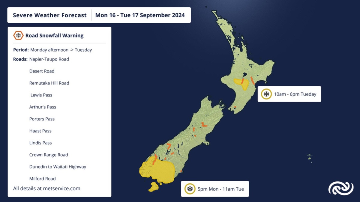
Another Heavy Snow Watch has been issued for areas south of Queenstown from this evening until Tuesday morning. However, this time around the cold air and snow potential spreads up to the North Island as well.
This relatively widespread risk of snow has meant our Severe Weather team has issued Road Snowfall Warnings across all the roads we cover. So, if you’re driving over one of the higher roads before Wednesday, check our Warnings page to see if snow is forecast.
MetService meteorologist Lewis Ferris says the cold air moving up the South Island will bring another top up of snow but also hazardous driving conditions on Tuesday.
Frosts will also be back on the cards Tuesday morning but more widespread on Wednesday morning. Queenstown has a forecast high of just 6°C on Tuesday but most places rebound back to average temperatures on Wednesday.
Generally, we see a slight easing in the nation’s weather on Wednesday but it’s a brief respite as more persistent rain falls on the west coast of the South Island on Thursday.
Friday brings yet another band of rain across the country from the west.